Bagian ini belum diterjemahkan, jadi ditampilkan dalam bahasa Inggris.
Sejarah
Ghiyath al-Din Tughluq ruled from 1320 to 1325 as the first sultan of the Tughluq dynasty, which took over the Delhi Sultanate from the Khaljis1. In 1321 he founded Tughlaqabad, the fourth city of Delhi, a stone fortress on a rocky height3,4. Archnet says he built his tomb during his lifetime, as a small fortress in an artificial lake outside the city’s southern wall, joined to the fort by a raised causeway1,4. Alexander Cunningham of the Archaeological Survey thought instead that his son Muhammad built it4. In 1325, returning from a successful campaign in Bengal, the sultan was killed at Afghanpur when a pavilion put up in three days collapsed after a feast1,3.
The chronicler Barani blamed a thunderbolt; Ibn Battuta claimed the pavilion was built to fall when elephants were paraded past, an account the ASI’s 1922 list judged not very reliable3. A popular legend has the Sufi saint Nizamuddin Auliya, with whom the sultan was at odds, foretelling his end with the words “Delhi is still far off”3,4. The sultan was carried to his tomb that night and buried there3. His son Muhammad bin Tughluq, who died at Thatta in 1351, was brought back to lie beside him, although the 1959-62 survey considered his grave open to debate1,2,3. Firoz Shah Tughluq later gave the mausoleum, which he called Dar al-Aman (“abode of peace”), doors of sandalwood3.
Arsitektur
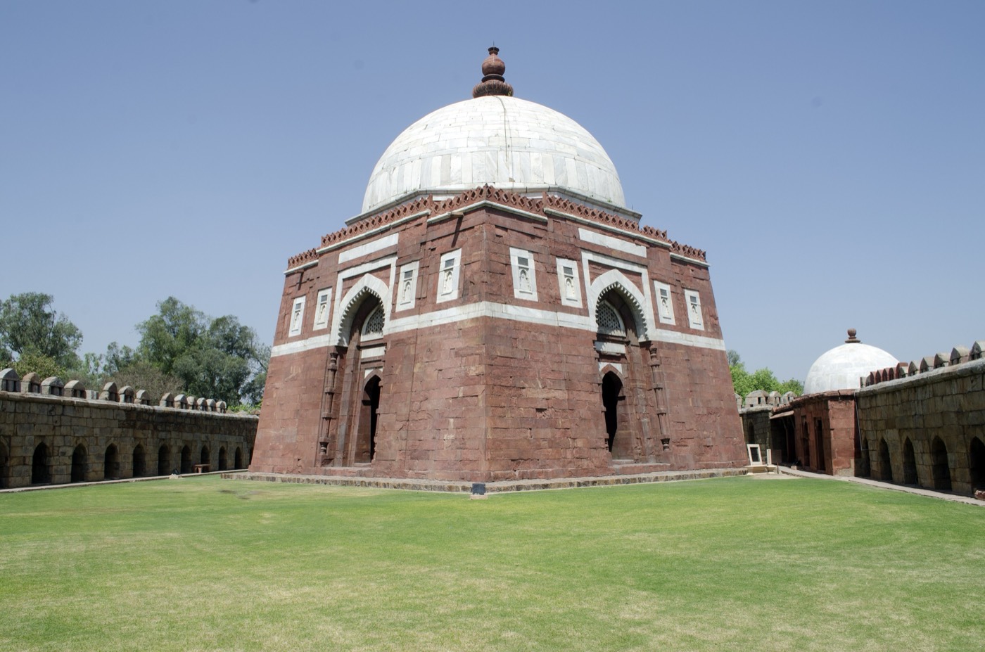
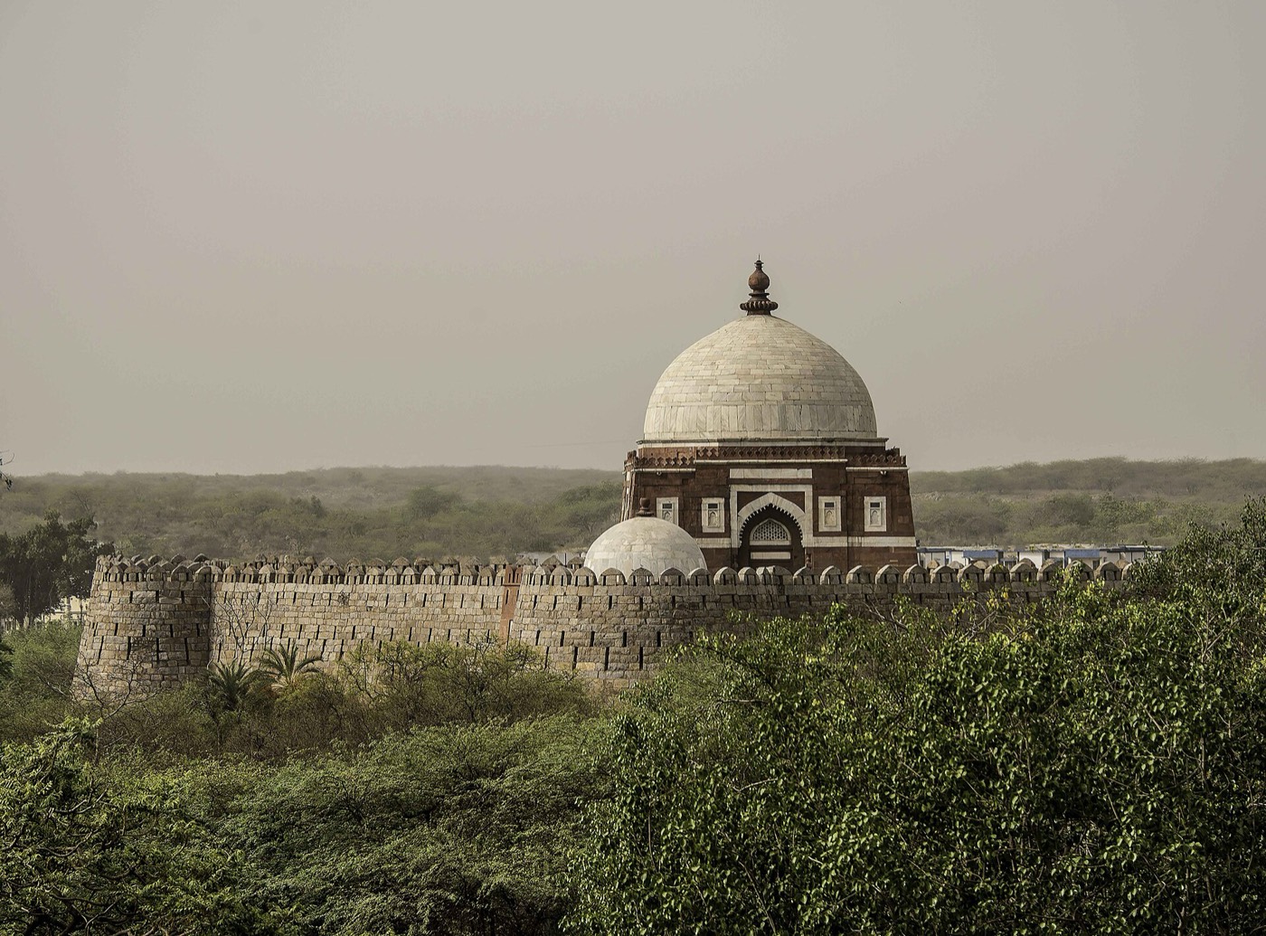
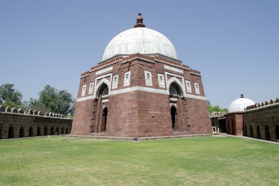
The tomb stands inside an irregular pentagonal enclosure with battlemented walls, bastions at the angles and rows of small vaulted rooms along the inner face, so that the whole reads as a small fort1,2,3. A high red sandstone gateway and a flight of steps lead in from the causeway, which Cunningham gives as 600 feet long on 27 arches and Archnet as 229 metres on 26 arched piers1,3,4. The tomb is square, about 18.7 to 18.9 metres a side, and its red sandstone walls slope inward at about 75 degrees; they are 11½ feet thick at the base and 4 feet at the top1,2,4. The doorways on the north, south and east sit in tall pointed horseshoe arches of white marble with a spearhead fringe, each topped by a small arched opening filled with a marble lattice screen; the west wall holds the mihrab1,3,4.
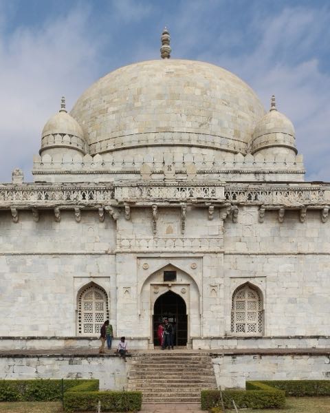
Colour does most of the decorative work: bands and borders of white marble and a few panels of black marble set against the red stone, with a band of upright marble slabs around the base of the dome4. The white marble dome rises from a low octagonal drum and ends in a red sandstone finial shaped as a vase and melon (kalash and amalaka), a form Archnet relates to the Hindu temples of the Delhi region1,3. In a bastion north of the gate stands the small octagonal tomb of Zafar Khan, a young commander; its inscription says the sultan built the Dar al-Aman for him, and the ASI’s 1922 list took it to be the oldest tomb in the enclosure2,3. James Fergusson, quoted by Cunningham, called the whole “a picture of a warrior’s tomb unrivalled anywhere”4.
Interior
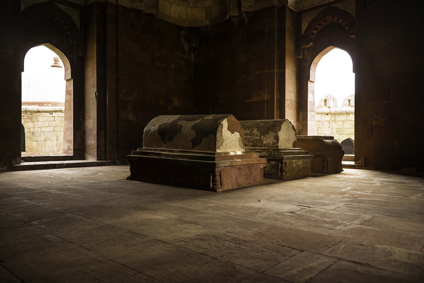
The single chamber measures about 11.7 metres a side inside1,4. Red sandstone faces the lower walls and white marble the upper surfaces leading to the dome, which rests on squinches across the corners; the floor is paved with red sandstone1,2. Apart from the marble-clad mihrab in the west wall, the interior is plain1. Three plastered graves lie in a row: the central one is taken to be that of Ghiyath al-Din, and the other two are assigned to his wife Makhduma-i Jahan and to Muhammad bin Tughluq1,2,3.
Yang perlu diperhatikan
- Red sandstone walls sloping inward at about 75 degrees, edged with bands of white marble1,4.
- The white marble dome on its low octagonal drum, with a vase-and-melon finial1,3.
- Horseshoe arches with spearhead fringes over the doorways, and marble lattice screens above them1,3.
- The pentagonal walled enclosure with its bastions, built like a small fort1,3.
- Zafar Khan’s small octagonal tomb in the north bastion, with its foundation inscription2,3.
Kunjungan
- The tomb lies south of Tughlaqabad Fort, on the far side of the Qutb-Badarpur road, and the ASI manages it together with the fort2.
- The enclosure is entered from the causeway through a high red sandstone gateway, and a flight of 32 steps leads up to the level of the tomb3.
- The ASI list of protected monuments names Zafar Khan’s tomb as that of Daud Khan, a name the ASI’s 1922 list traced to a misreading of its inscription3,6.
Informasi resmi: Archaeological Survey of India (ASI), together with Tughlaqabad FortPetunjuk arahBuka di OpenStreetMapTur berpemandu di Delhi